


ORVIL 1 Voting District, Logan County, Illinois
About
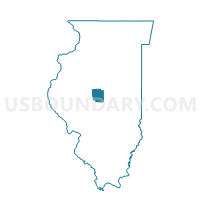
Outline

Summary
| Unique Area Identifier | 572703 |
| Name | ORVIL 1 Voting District |
| County | Logan County |
| State | Illinois |
| Area (square miles) | 19.71 |
| Land Area (square miles) | 19.71 |
| Water Area (square miles) | 0.00 |
| % of Land Area | 100.00 |
| % of Water Area | 0.00 |
| Latitude of the Internal Point | 40.29855300 |
| Longtitude of the Internal Point | -89.43616430 |
Maps


Graphs
Select a template below for downloading or customizing gragh for ORVIL 1 Voting District, Logan County, Illinois


Neighbors
Neighoring Voting District (by Name) Neighboring Voting District on the Map
- BOYNTON 1 Voting District, Tazewell County, IL
- DELAVAN 1 Voting District, Tazewell County, IL
- EMINENCE Voting District, Logan County, IL
- HITTLE Voting District, Tazewell County, IL
- ORVIL 2 Voting District, Logan County, IL
- PRAIRIE CREEK Voting District, Logan County, IL
Top 10 Neighboring County Subdivision (by Population) Neighboring County Subdivision on the Map
- Delavan township, Tazewell County, IL (2,061)
- Orvil township, Logan County, IL (1,068)
- Hittle township, Tazewell County, IL (591)
- Prairie Creek township, Logan County, IL (487)
- Eminence township, Logan County, IL (421)
- Boynton township, Tazewell County, IL (275)
Top 10 Neighboring Place (by Population) Neighboring Place on the Map
Top 10 Neighboring Unified School District (by Population) Neighboring Unified School District on the Map
- Olympia Community Unit School District 16, IL (12,153)
- Delavan Community Unit School District 703, IL (2,731)
- Hartsburg-Emden Community Unit School District 21, IL (1,283)
Top 10 Neighboring State Legislative District Lower Chamber (by Population) Neighboring State Legislative District Lower Chamber on the Map
Top 10 Neighboring State Legislative District Upper Chamber (by Population) Neighboring State Legislative District Upper Chamber on the Map
Top 10 Neighboring 111th Congressional District (by Population) Neighboring 111th Congressional District on the Map
Top 10 Neighboring Census Tract (by Population) Neighboring Census Tract on the Map
- Census Tract 219, Tazewell County, IL (4,677)
- Census Tract 220, Tazewell County, IL (4,354)
- Census Tract 9530, Logan County, IL (2,593)